Imagens do dia 01.02.2015 do Ciclone Tropical Ola próximo a Nova Caledônia.


Ciclone Tropical Ola dia 31.01.2015 categoria 1 imagem visível
| Last Updated | 01/02/2015, 04:00:00 (Hora oficial do Brasil) | ||
| Location | -20.5N 197.7E | Movement | S at 9 mph |
| Wind | 150KPH | ||
| Last Updated | 31/01/2015, 16:00:00 (Hora oficial do Brasil) | ||
| Location | -18.9N 198E | Movement | S at 6 mph |
| Wind | 120KPH | ||
accuweather.com
Tropical Cyclone Strengthens Near Australia
Ola is expected to drift to the south or southwest through Sunday bringing bands of heavy rain and strong wind to New Caledonia. However, the center of the cyclone, along with the worst of the conditions, are expected to remain to the west of the island.
Despite this, 50-100 mm (2-4 inches) of rain and wind gusts near 80 kph (50 mph) are expected to pound the Island, especially western areas. Rough surf and dangerous rip currents will affect all coasts.

As Ola drifts to the south through the start of the week it is expected to move into an area of increased wind shear. This wind shear will work to stop any ongoing strengthening and will eventually weaken the cyclone.
RELATED:
Australia Weather Center
South Pacific Tropical Cyclone Center
Detailed Forecast for Brisbane, Australia
While the track of the system is still unclear during the middle of the coming week, with the wind shear expected to increase and weaken the system, the threat for significant impacts from the cyclone will greatly lessen.
With the significant weakening expected, the coast of eastern Australia is expected to remain free of significant impacts. However, beachgoers and boaters from northern New South Wales into southern Queensland should remain alert for rough surf and rip currents through the middle of the week.
With the exact track of the storm still unclear during the middle of the week, anyone with interests in the Coral Sea or along the coast should keep alert for updates.
radionz.co.nz
Cyclone Ola not expected to reach land
Updated at 8:02 pm on 31 January 2015
A category 1 tropical cyclone is moving slowly northwest of New Caledonia but is not expected to reach land.
The New Zealand Metservice says Cyclone Ola is in open waters, and is not expected to make landfall, or pose any risk to New Caledonia.
As of 8pm Saturday, New Zealand time, the cyclone was 300 kilometres northwest of New Caledonia.
Meanwhile, the Fiji Metservice says a weather system near Samoa has weakened, and is not expected to develop into a cyclone.
Samoa is continuing to experience heavy rain, with some low lying areas around Apia flooded.

Some families in Matautu-uta village as well as Taufusi, Fugalei, and Saleufi in the town area have also been affected.
Rivers are also flooded, and families living nearby have been warned to move to higher ground.
And in American Samoa over four inches of rain fell overnight with the national weather service continuing a flash flood watch for Tutuila and Aunuu until tonight and a warning for Manu'a.
Our correspondent there says the heavy rainfall experienced last night may be mild compared to the pounding Manu'a has been getting since early this morning.
Meteorologist Elinor Lutu McMoore says people should prepare for continued heavy rainfall and gusty winds today.
"What's affecting us in terms of the showers and the winds is really this active monsoon trough that's sitting stationary over the Samoan islands."
Elinor Lutu McMoore says the monsoonal trough lying over the Samoa group is expected to gradually move away by tomorrow.
All catholic schools and Manumalo baptist School have cancelled classes for today.
The New Zealand Metservice says Cyclone Ola is in open waters, and is not expected to make landfall, or pose any risk to New Caledonia.
As of 8pm Saturday, New Zealand time, the cyclone was 300 kilometres northwest of New Caledonia.
Meanwhile, the Fiji Metservice says a weather system near Samoa has weakened, and is not expected to develop into a cyclone.
Samoa is continuing to experience heavy rain, with some low lying areas around Apia flooded.

Flooding in Apia.
Photo: RNZI / Autagavaia Tipi Autagavaia
Rivers are also flooded, and families living nearby have been warned to move to higher ground.
And in American Samoa over four inches of rain fell overnight with the national weather service continuing a flash flood watch for Tutuila and Aunuu until tonight and a warning for Manu'a.
Our correspondent there says the heavy rainfall experienced last night may be mild compared to the pounding Manu'a has been getting since early this morning.
Meteorologist Elinor Lutu McMoore says people should prepare for continued heavy rainfall and gusty winds today.
"What's affecting us in terms of the showers and the winds is really this active monsoon trough that's sitting stationary over the Samoan islands."
Elinor Lutu McMoore says the monsoonal trough lying over the Samoa group is expected to gradually move away by tomorrow.
All catholic schools and Manumalo baptist School have cancelled classes for today.




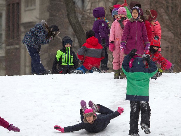 Crianças brincam na neve no Central Park, em Nova York, nesta segunda-feira (26) (Foto: Reuters)
 Avião é descongelado (Foto: Seth Wenig/AP Photo)
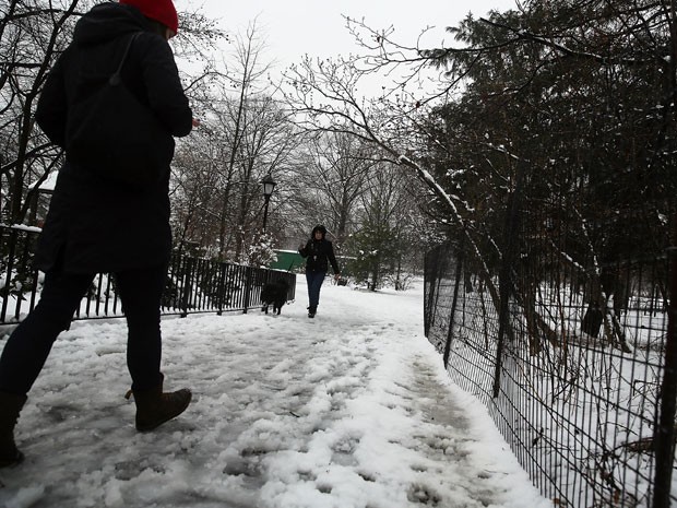 Prospect Park, no bairro do Brooklyn, em Nova York, está coberto pela
neve em foto deste sábado (24): nevascas estão previstas para o nordeste
dos Estados Unidos (Foto: Spencer Platt/Getty Images/AFP)
